Home | MyGov

Accessibility
Accessibility Tools
Color Adjustment
Text Size
Navigation Adjustment
Screen Reader iconScreen Reader

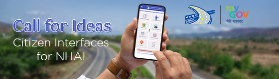
Call for Ideas - Citizen Interface for NHAI

Call for Ideas - Citizen Interface for NHAI
Start Date :
May 14, 2022
Last Date :
Jun 15, 2022
23:45 PM IST (GMT +5.30 Hrs)
Submission Closed

National Highway Authority of India currently is planning to build a citizen facing interface which can cater to all highway related needs of NH commuters. NHAI already has an ...

National Highway Authority of India currently is planning to build a citizen facing interface which can cater to all highway related needs of NH commuters. NHAI already has an Android mobile application called Sukhaad Yatra (https://play.google.com/store/apps/details?id=com.rsawh.nhia&hl=en_IN&gl=US) which needs to be upgraded and advanced further.

Citizens are invited to share their ideas on how the Sukhad Yatra app can be improved with additional features/ integrations to better service the needs of citizens. The end outcome is to improve the experience of NH commuters and build a robust medium of 2-way communication.

The tool will not be limited to but can cover the following areas:
● Informing users of construction and maintenance activities
● Allowing users to register complaints pertaining to the condition of the highway or highway activities such as toll (for eg. If wait times for a toll gate are too long or if FasTag is not working at a gate)
● Allow users to rate highways on various characteristics of the highway around their experience as a rider (on both negative and positive characteristics of experience, for example whether the NH offers a scenic route or view)
● Allow user to access emergency and first response services on the highway
● Allow users to access information on wayside amenities, petrol pumps, EV stations etc. Information about location of facilities along the route can be searched on Google Maps but this is hard to access for non smartphone users.
● Allow users to report traffic congestion, accidents, debris, toll-relates issues, request EV charging points etc to local command centres (Eg. Waze)
● The interface should be able to cater to user-needs of commuters with and without smartphones
● The interface should have a strong focus on UX, intuitive and centred around the day-to-day needs and experience of highway users.

The interface can also operate as a platform through which multiple existing private and public applications can link to such as NH’s toll free number, toll management system etc or travel related apps (MapMyIndia, Google Maps etc) which already have a high user-base. The platform should leverage strengths of existing IT applications and not reinvent where necessary.

The design should cater to all kinds of NH users such as:
● Commercial (trucking etc) who may or may not have a smartphone and a user design which caters to their needs
● Personal long-distance commuter which may not be as frequent but may have access to smartphones
● Local residents who live around the highways and use it more frequently than private long distance commuters

Submissions to this can be in the form of app mock-ups/ prototypes, presentations, concept notes on platform and other interfaces, list of desired features by commuters etc.

Tha last date of submission of ideas is 15th June 2022.

Reset
Showing 1285 Submission(s)
RIJILESH
RIJILESH 4 years 1 month ago
Excessive speed, carelessness and unscientific road construction are the leading causes of accidental deaths. Excessive speed should be remedied with a hefty fine. Build road construction scientifically in a way that minimizes accidents
NANDAN SHERLEKAR
NANDAN SHERLEKAR 4 years 1 month ago
NHAI is our economies arteries. Fuel savings & time is the ultimate goal. We have to win the race of becoming green economy. We are focusing on hydrogen fuel this has to happen on war footing to save ourselves from the clutches of oil producers cartel. Inflow of foreign exchange goes towards fossil fuels. Hydrogen & EV vehicles are the future with charging stations. 1 kg of water with electrolysis we get 111gms of hydrogen & 889 gas of oxygen.This oxygen is large quantity has to be utilized in combustion to increase thermal efficiency which can be highly cost effective. Normal air has 20% oxygen and approximately 80% nitrogen. When we enrich combustion with oxygen there will be substantial savings in petroleum or coal consumption. So the hydrogen plant has to be nearer to utilize excess oxygen for thermal plants, refineries, steel plants, major industries requiring heat for process, municipal waste incinerators.The network for hydrogen needs to be planned to avoid transportati contd--
Raghu Sinha Pendyala
Raghu Sinha Pendyala 4 years 1 month ago
Hi my suggestion is for under tunnel between Dahej and Bhavnagar and a similar tunnel between Jamnagar and Mundra. Shared entry to the discuss on MyGov. More details at https://www.mygov.in//comment/126880701/#comment-126880701/
Dr Arup Barman
Dr Arup Barman 4 years 1 month ago
This my submission that government should initiate GPRS and Google Map Based Feed system integration. It will enable the passengers and travellers and drivers to gove the feedback on the road repairing conditions, illegal and double taxes on transport and other irregularities and harassment faced by the taxpayers. Every passenger pay on the road, but there are double-taxed imposed in many palces and spots. that needs to be controlled by the government.
Krishan Gopal Maheshwari
Krishan Gopal Maheshwari 4 years 1 month ago
App to show 1) Amenities available nearby 2) Highway Radio. 3) Speed limit alerts. 4) Driving hazards, traffic crashes, red light cameras. 5)Touch button to communicate /phone call with your contacts in your device. 6)Solar powered roadways if any. 7) WiFi transmitter location. 8)Glowing markers painted on roadways. 9)Interactive lights to illuminate a particular section of roads when vehicle approaches for night visibility. 10)Encourage collaboration between transport authority, app developers, automotive industry to unlock full value of data & connectivity in helping make roads safer. 11)Safety messages on lane closures, speed restrictions, incidents, warning drivers of large vehicles to nearby vulnerable road users (cyclists) or pedestrians.12) Drone connectivity to track. 13)Info on Cabotage law if any. 14)Speedy database is essential with security. 15) Multi-stop route planner. 16)Make app icons / elements consistent across platforms. 17) Slow down alerts at road maintenance Sites
Krishan Gopal Maheshwari
Krishan Gopal Maheshwari 4 years 1 month ago
App to provide real-time 1) offline maps in remote areas or dark 2) Weather forecast 3) Digital Journal to write your visit & filling with own photos. 3) To show all nearest hiking trails, be it leisurely stroll or a KM long mountain hike. 4) To show Flush Toilet Finder with info on cleanliness, handicap accessibility. 5) Potholes locations & water flooding with estimated height of water on roads. 6) Toll info- nearby, charges, adding total Toll costs. 7) Locate nearest Medical Aid. 8) Speed limit for schools on highway. 9) Full Lightbulbs info on every highway to travel in night. 10) Info on Tourist information center nearby. 11) Road construction or land slides with alternate routes. 12) Deals on Hotels on highways. 13) Interstate Entry/Exit Guide. 14) Music Radio. 15) Allow to listen books on devices. 16) Family car Games. 17) Shopping shops info. 18) You should easily scroll thru your history of visiting places. 19) Track Expenses tool. 20) Road trip detours for scenic attractions
Krishan Gopal Maheshwari
Krishan Gopal Maheshwari 4 years 1 month ago
1)Please bring app into iOS platform also. 2) App must let’s know & share (mail or FB or twitter etc)about: Road alerts;Traffic Jams ; Accidents, police activities; Best route; Road ahead looks like following a rainstorm ; Fuel (petrol, diesel, electric, CNG ) & vehicle Service stations with directions; Find the cheapest fuel in area; Sort fuel stations by distance & compare fuel prices; Find the closest Restaurant, Restrooms & Retail Mall; Search for playgrounds/parking areas,WiFi ; Populate the nearby attractions, monuments, fascinating/ offbeat places, picnic spot, eateries, lodging ; Stocks with reviews, ratings & comprehensive info from local experts & travel writers; Tells approximate travel time, distance & fuel cost; Use the app to learn the history of places on highways including architecture, museums, battlefield, famous home; Displays locations in zoomable map based or scrolling list view; App to provide map offline to guide routes when there is no internet network in Remote
Varun
Varun 4 years 1 month ago
To railway minister& E.sreedharan sir (Chengannur --pampa railway project idea) 1)connect chengannur--pamba rail& angamali--erumeli railway line at "vadaserikkara railway station" Make it as a junction,,abile to divert the train to anywhere,,to pamba ,,chengannur,, angamali or punalur etc etc 2)then extent the railway to punalur from vadaserikkara railway station,,so it can be useful for trade&tourism(vizhinjam international port),,because sabarimala pilgrimage is only 3,,4 times only per year 3)so from vadaserikkara any train from chengannur or from angamali/erumeli can divert to any locations...they can go to punalur,,chengannur,,angamali etc etc 4)use a small 1 km viaduct railway bridge for connecting " erumeli--vadaserikkara station" bcz we know chengannur-pampa railway line is standing above the pillars 5),From punalur connect it with vizhinjam international sea port...varun